WPS - the first harvest

jmumby

Senior Member
Well I took the white hat war driver out on the weekend for a quick drive. Unfortunatly for some reason my GPS was some 3 degrees out so I have a perfect set of pinpoints just at the base of the (NZ) southern alps. Quite upsetting. This was fixed by connecting the GPS to the SiRF demo software that somehow fixed it so I can have another crack later on.

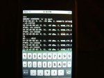
The tool has no screen or control panel as such so I connect via the spare wireless port and telnet in using my IPOD. I have some photos attached.

I hope to have some google earth KML files shortly to show. So yes hippy was quite right this has kept me off the streets for some time but againts the odds it appears to work.

Max 3 access points every 3-4 seconds probably 6 with 28x2.
 

Attachments

Dippy

Moderator
Well, firstly a 'Well Done' from the technical point.

I gotta ask a question or two as this is very novel to me. i.e. it sounds a bit strange.

1. What is 'white hat war driver'? Are any helmets involved?

2. What is the point of WPS when you have GPS? And will you be arrested for Kerb Crawling? Do you wear Cammo / Combats and drive along darkened streets at 5mph?

3. Where is the WPS in your project? It all seems GPS?

I've probably completely misunderstood, so sorry if I sound flippant.
 

jmumby

Senior Member
1. What is 'white hat war driver'? Are any helmets involved?
In the hacking world you are either a white hat or a black hat. A white hat uses technical information in a non-invasive way. A black hat will use the information to exploit and profit from hacking. In this case he would log all the open access points and go back in the middle of the night an torrent as many movies the open access point would provide. Or hack into the open network to gain passwords etc.

2. What is the point of WPS when you have GPS? And will you be arrested for Kerb Crawling? Do you wear Cammo / Combats and drive along darkened streets at 5mph?
Not all devices come with GPS. Like PDA's and IPODS such as the one that I use to control it. I wear a ninja suite. This is actually a green white hat as it was designed for a bike but I have used it the car at speed and it performs well. This may seem mad but there are actually companies that do this for a living. Do a google on skyhook.

3. Where is the WPS in your project? It all seems GPS?
This unit has a 802.11b/g to rs232 converter that sniffs out mac address + GPS + uSD card reader writer.

My post in completed projects is much more specific http://www.picaxeforum.co.uk/showthread.php?t=9058
 

Dippy

Moderator
Thanks. Please don't think I'm knocking it. I'm not. It's got my cerebellum in a right fizz.


What I'm trying to work out is...
you've made an excellent GPS adaptor to work with your ipod. So why bother with wps?

If I get this right, you seem to have a secondary 'box' connected to ipod, so why not just have GPS?? Then you can cruise into the wilderness still viewing the screen to see where you are.

As a technical exercise you've done a great job, but I honestly can't see the reason/purpose in the Real World. If it's just for a demo, then damned well done.

"This may seem mad but there are actually companies that do this for a living" - yes, it seems completely barking. Driving round streets hoping to get a Wireless signal, when in most cases you can get a reliable GPS signal or read a road sign.

I suppose what I'm trying to say is; Why would anyone want to do it? Why is it important? Why use the gas? Why not just get a GPS base device?
I'm seriously interested and simultaneously confused.
Sorry, I'm totally lost on this and I haven't even been down the pub.


On a non-serious note:-
A Ninja SUITE? Is that like a Japanese 3 piece suite? A silent black killer sofa and matching armchairs.

Thanks for explaining Black Hat / White Hat; but where is the 'War Driving'?
 

hippy

Ex-Staff (retired)
It seemed odd to me at first but I can see its potential use. When this part of the job is done, anyone mobile with a WiFi card can identify a nearby access point, look that up in the database and get its co-ordinates and thereby know where one is, which is great if one has WiFi but not GPS.

While jmumby has had to buy a GPS and do the war driving and logging of access points, everyone else with WiFi will benefit without having to either buy a GPS or build the database themselves.

I'd call it a worthy philanthropic venture; spending ones own funds so others can benefit from the database with no extra expenditure of their own. It's not about how much it cost to do this ( and what else could have been done with the same cash ), but how it can save others money when they don't need to buy a GPS and can get location services using just their WiFi card.

The same could be done with cell phone masts as each has unique cell number and the cell number can be read quite easily from a phone. In that instance though the network operators change numbers so it's near impossible to keep an accurate database of cell phone masts.

"War driving" is the act of going around looking for or identifying open access points, claimed to have derived from "war dialling" ( doing the same with modem calls in the hope of finding a computer to get free services ) which in turn is purportedly a reference to the film War Games where the protagonist was doing that.
 

jmumby

Senior Member
I was going to post some huge reason for this all but Hippy has pretty much got in a nutshell. As for cost it would be lucky to be more than $150US
 

manuka

Senior Member
I'm a great fan of cost effective democratic technological approaches, but still feel any WiFi based "where am I" locality service will only give VERY broad insights in built up areas where GPS may fall over. Skyhook's approach seems marvellous => www.primidi.com/2005/05/27.html , but (as already mentioned) -

* Even in business districts WiFi Access Points (APs) come & go- they can be suddenly switched off, moved around at short notice (as folks rearrange the partitions/furniture or perhaps move away), OR the AP may be even be upgraded. My home setup here undergoes all of these FREQUENTLY- it's standard security practice to switch OFF an AP outside working hours.

* APs are often NOT omnidirectional, but thanks to simple antenna (such as -ahem- my own humble wokfi offerings => www.usbwifi.orcon.net.nz), signals may be beamed. Even in the clear hence a WLAN may be near invisible from some approaches.

* Random signal obstruction (maybe even from parked vehicles, seasonal vegetation changes or even varying atmospheric moisture) & reflections gives unexpected "view alleys" & attenuations. Using NetStumbler & a roving laptop, I can detect APs 10km away across Wellington harbour, but in some spots on my property not my own WLAN- even moving a few feet will however totally change this. This is especially an issue with hills as almost nothing may be seen in a valley blind spot, yet scores of LOS APs may well suddenly show when cresting the hilltop.

* The spot at which your GPS returns a detected AP is NOT exactly where the WLAN is located, as it may well be km away. Only by monitoring signal strengths ( "the closer the stronger" ) can you really get proximity insights, & even then obstacles can greatly influence strengths. Naturally triangulation will be even better.

For informative value, & if you've a $$$($) laptop/PDA already running (perhaps in a taxi,bus or train at night),detection of 2.4GHz WiFi APs en route may be very useful- if only to alert (maybe ~100m away) to approaching suburbs & the next stop . Much the same thing can be done with GSM cell phones returning their linked cell tower of course, although this is even broader (~km). The latter has given my kids a self directed "Are we there yet?" info. service on many a long car journey.

I'd be delighted to hear how these issues may be overcome! Stan
 
Last edited:

demonicpicaxeguy

Senior Member
i really wish i could find it,
but i read an article about a decade ago about a positioning system that used directional antennas coupled with a set of known radio stations to get a "rough" location by looking at the different angles between them, this was well before gps modules became affordable to the average tinkerer

the best parts about it was it didn't need to store thousands of records to be usable over say somthing the size of the average city,

the problem with it was that it was really only accurate down to 500metres and even then it questionable,

the main motivation behind it was as a backup navigation system for passenger aircraft to gps systems

needless to say it didn't see much light.
 

manuka

Senior Member

Radio direction finding (RDF) & location is a vast field, with radio ham "FOX HUNTING" a very technical pursuit. Lower freq. (~45 MHz) wireless location systems have been around since the 1930s, & were part of WW2 "Battle of the Beams" bomb aiming systems. Google for the likes of Lorenz, X-Gerät, Wotan, or read => en.wikipedia.org/wiki/Battle_of_the_Beams . N.B. One of the most riveting applied science books you can read is RV Jones "Most Secret War" in fact - I must have read my copy a dozen times over the years & still find it a technical "bodice ripper"!

In spite of GPS the LORAN (LOng RAnge Navigation) system (~100kHz or ~1.8MHz) is still alive too. Although these lower freqs punch thru' obstacles readily, at great distances ( ~1000km) the associated night time sky wave can make accuracy pretty modest ( ~1 mile)- tolerable for off shore vessels. I recall it's use (pre GPS 1986) on my brother in laws salmon fishing boat, while off the very foggy Californian coast.

Classic nulling loops & even good old ferrite rod based triangulation DF can be used on LW/MW (light aircraft & coastal vessels style) - apparently Dec 1941 Pearl Harbour raiders infamously homed in via Hawaiian AM stations this way...
 
Last edited:

Dippy

Moderator
Well, you've done a nice bit of work.

I suppose there are parallels with GSM positioning. I hope no-one changes their MAC address in the same way as hippy says cellphone masts change. Anyway, more and more mobiles with GPS will abound soon, and at lower and lower prices.

hippy: "The same could be done with cell phone masts as each has unique cell number and the cell number can be read quite easily from a phone. In that instance though the network operators change numbers so it's near impossible to keep an accurate database of cell phone masts."
- are you totally sure about that? GSM positioning (and I CAN see the point of this) is pretty big. So you are saying that these Companies have to regularly contact SPs to see if they've changed their numbers? If so, how dumb.
I read that in the US that mobile phone operators had to be able to locate 911 callers via GSM some years ago. A real pain if all the different Operators/SPs keep changing. And what's the point of changing? Are you muddling 'changing' with 'mast infill'? (where I could perfectly understand the apparent observed ID Number change).

Anyway, I've got to fiddle with me SPI now, and the vision of jmumby dressed as Laura Croft zooming around the backstreets in a Land Rover are going to persist - for which I'm not at all grateful ;)
 

MartinM57

Moderator
N.B. One of the most riveting applied science books you can read is RV Jones "Most Secret War" in fact - I must have read my copy a dozen times over the years & still find it a technical "bodice ripper"!
Remarkable - I thought I was the only nerd to have the hardback version of this book and also to re-read it every 5 or so years :)

I'd thoroughly recommend it.

I see that Wikipedia has an entry for him
http://en.wikipedia.org/wiki/Reginald_Victor_Jones
...and that he wrote two more books in 1988/89. I shall be putting a request in to the local library...
 

jmumby

Senior Member
First KMZ file

Ok chaps here is the results from the first harvest. I would have posted these earlier if I had of know that most mapping software uses decimal notation where GPS use degrees minutes or DMM. The format is ddmm.mmmm or dddm.mmmm those toying with gps will soon find that the data they get from the GPS will not work without conversion to decimal. If you ask nicely I can give you the formula (will post in finished projects). I trolled the web for about 5 hours for this priceless information. Well information is readily available it's getting excel to convert it that is the major. It is a relatively simple equation so I may be able to get the picaxe to convert on the fly.

Anyhue the plots are of me driving into work. On the edge of the city I had to turn off the car and start again but the GPS would not get a fix again so a big blind spot here. The tool at the moment is too big for the dash so sits on the front seat, not the best for reception.

Also I am still suffering from the 16th byte corruption EVERYTIME this is not the lantronix so I assume the picaxe has a firmware bug.

I have left the duplicates so manuka can say he told me so.

You will have to remove the .txt so you only have .kmz, oh and google earth.
 

Attachments

Last edited:

Dippy

Moderator
"..so I assume the picaxe has a firmware bug."

Possibley, but re-arrange these words in the correct order to find the usual solution:-
"tools" , "blames", "his", "A" ,"always", "workman", "bad".
:)

Anyway, good luck. Let us know how you get on after it's perfected.
 

jmumby

Senior Member
Well the data going in is not corrupt but it is always corrupt in the same place in the scratch pad. Hsersin is pretty hard to cock up but hey I am capable of anything. I have asked for pointers before http://www.picaxeforum.co.uk/showthread.php?t=9085&page=2 but no one had a response. I would really like some help to sort it out so if you have something I can try please elaborate.
 
Last edited:

hippy

Ex-Staff (retired)
hippy: "The same could be done with cell phone masts as each has unique cell number and the cell number can be read quite easily from a phone. In that instance though the network operators change numbers so it's near impossible to keep an accurate database of cell phone masts."
- are you totally sure about that? GSM positioning (and I CAN see the point of this) is pretty big. So you are saying that these Companies have to regularly contact SPs to see if they've changed their numbers? If so, how dumb.
That was the state of play as I understood it, but it was a while ago. I'm not sure if location service companies, police etc, get regularly provided with a database of which cell mast has which number or if they lookup the number 'online' like a credit card check.

The main reason was apparently to stop what jmumby is doing. Changing cell mast numbers means any homebrew database will at some point become out of date and useless while companies who pay for the database will remain up to date and accurate.

Companies get the assurance that they won't be competing with free services derived through war driving and the SP's get the money from selling their database. I don't know if numbers do change or how regularly but it's possible. As soon as some free service is up and running a single command from upon high in the SP can stop that dead in its track.
 
Top